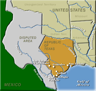
The Adams-Onís Treaty (1819) established a portion of the United States’ western boundary at the Sabine River, which separated the young republic from Spanish-held Mexico. In the succeeding years, Mexico achieved its independence from Spain and its northern regions became the destination of a large number of migrants from the United States. The lands of present-day eastern Texas were prime cotton territory and for some years the Mexican government welcomed the development of its most distant province, Tejas, meaning friend or ally in Spanish. As the number of foreigners increased, the Mexican government grew leery. These tensions culminated in the Texan Revolution of 1835-36.